I woke up with it still dark outside to the sound of a hard rain falling outside. I checked the weather forecast on my phone to see a quick band of passing showers, not bad. But then, zooming out, I saw a massive band of showers between me and my midday destination of Thunder Bay, Ontario. Today was going to be a rain gear day!
When my alarm went off, I packed myself up and grabbed my rain gear from the bike to install it in my riding suit. It was still pretty warm, so I started to heat up almost immediately as I got suited up. I was on the road around 8:00am and left the town of Marathon behind without checking much of it out as I tried to beat the rain.
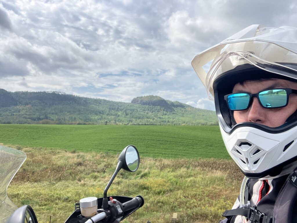
Back out onto the highway, and I was about 300 km (200 miles) from Thunder Bay, Ontario. The road was wet, but there was not much more than an occasional minor drizzle as I headed westward. The cloudy skies in front of me, with the sun rising in clear skies behind me made for some beautiful-looking photos of an impressive Ontario landscapes.
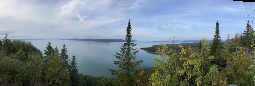
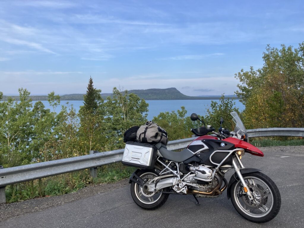
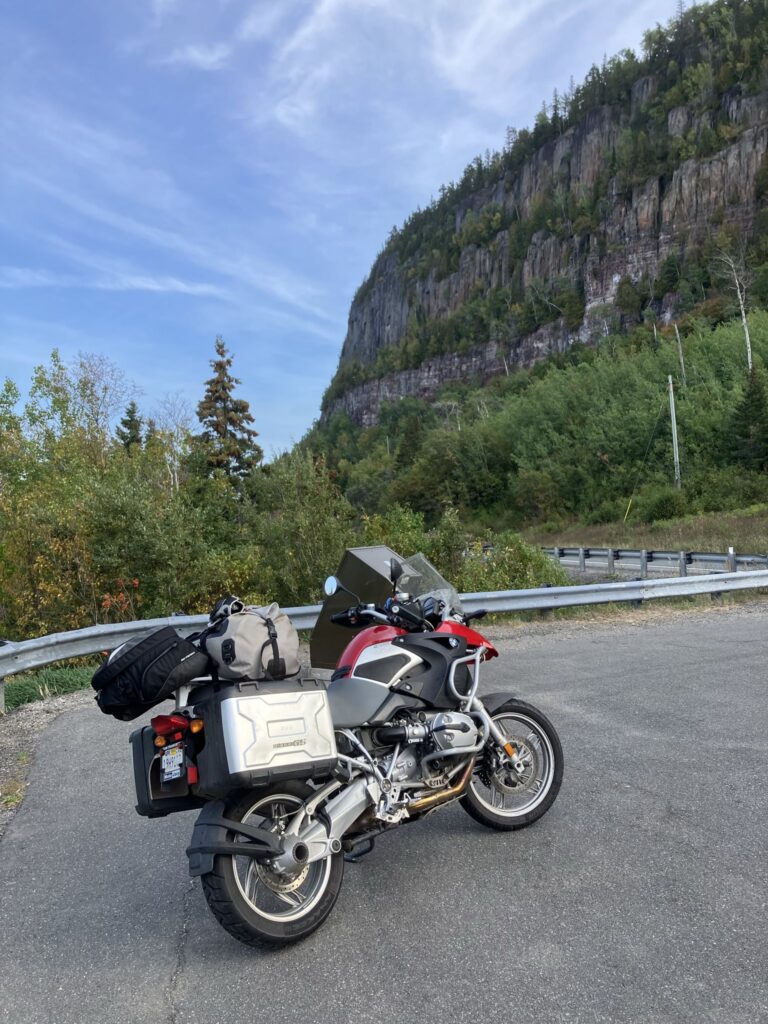
The highway and rugged lakeshore scenery was absolutely stunning, with vista points every couple of kilometers. I stopped in at several of them to take in the views and snap photos.
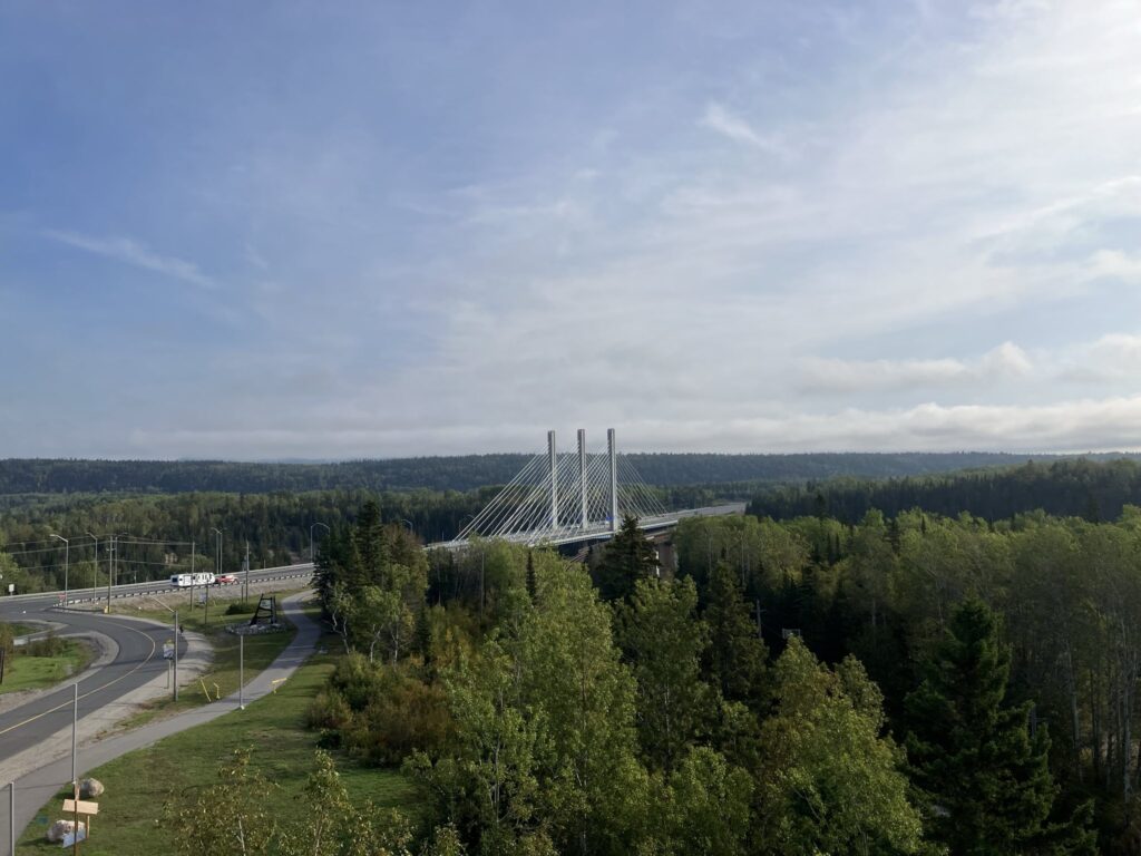
By around 10:00am, I had made it to Nipigon, Ontario, a spot where the two forks of the Trans-Canada Highway through Ontario merge together in a single road over the Nipigon River to Thunder Bay. It turns out, the bridge over the river had been replaced with a shiny, new cable-stayed bridge since I’d last been there, and the town had built an observation tower to take photos from.
After photos, I scouted a coffee shop in downtown Nipigon, and stopped in to caffeinate myself. There was a crowd of folks in there spreading gossip and news, and the barista working was a super-friendly retired school teacher and we chatted about just about everything as I enjoyed a nice coffee and butter tart. After my break, the weather was even warmer and starting to get sunny, so I got my rain gear out of my suit to cool off a bit.
Back onto the road, and the road construction came fast and furious. It seems that the province is going to try turning the stretch of highway between Nipigon and Thunder Bay into a divided highway, and the amount of blasting they were doing to make room for the widened roadway was really impressive.
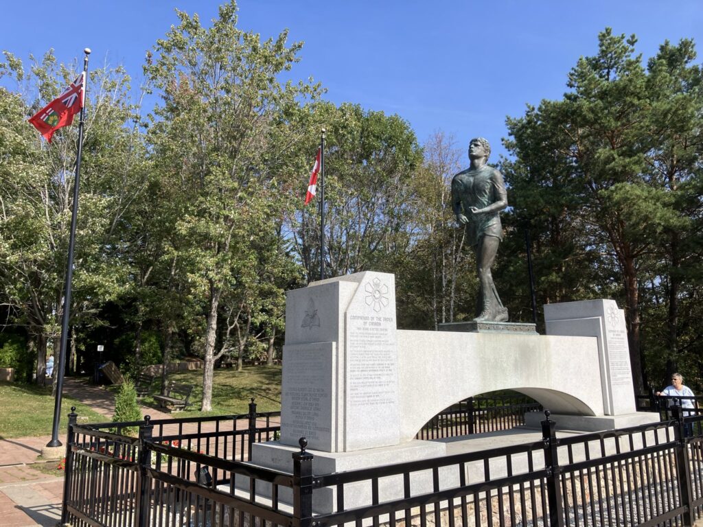
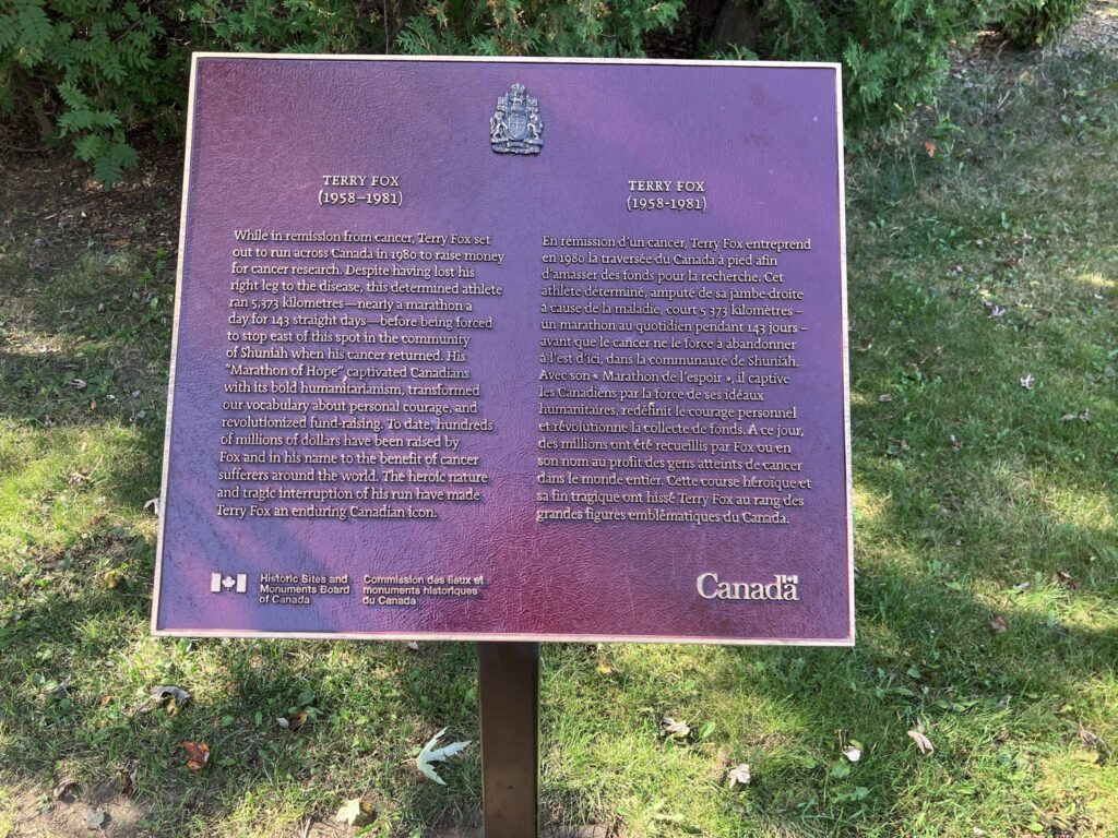
As I got close to Thunder Bay, I started passing signs marking the route as the Terry Fox Memorial highway. For folks that aren’t familiar, Terry Fox was a young Canadian, who in the early 1980’s began his “Marathon of Hope”, running a marathon distance of 26 miles, yes Canada was still using Imperial units back then), every day to raise money for cancer research, all while after losing his own leg to the disease before he began. Terry ran nearly 3000 miles from Newfoundland to Northern Ontario over the course of 1980, before having a relapse that halted his run just east of Thunder Bay, Ontario. I stopped in at the Terry Fox memorial for a moment of reflection and remembrance of this Canadian hero.
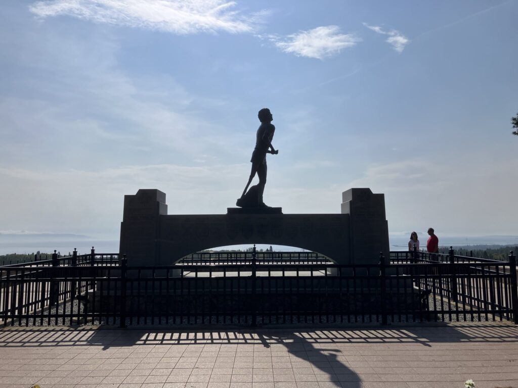
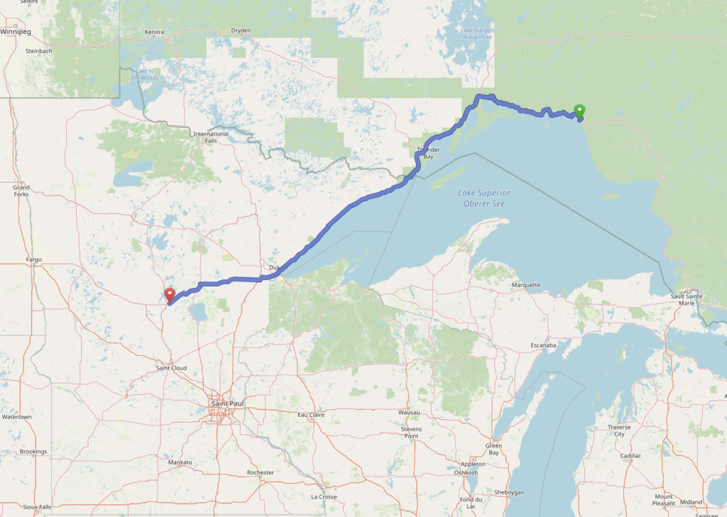
After taking in the views from the memorial overlook, I entered Thunder Bay proper, and toured through the city before finally leaving via highway 61 south toward the United States border crossing. I’d started on the Trans Canada Highway just outside Ottawa, with the markers reading 2200 km, and left it two days later with them still reading 700km more of Ontario to go. Ontario is one massive place!
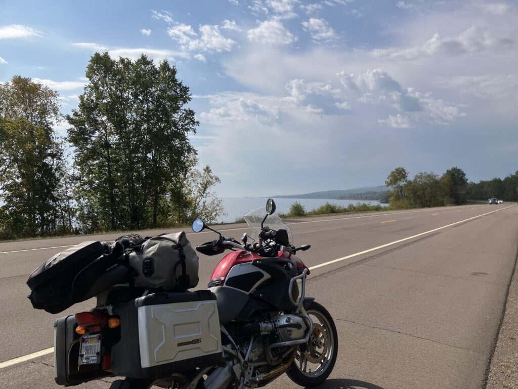
The terrain got a bit less rugged as I went along, but still featured big promontory mountains poking out of the flatter farmers fields every so often. After only about 40 minutes, I was at the border crossing and got my passport handy. Crossing the border was a simple matter, and I was into Minnesota and the Central Time Zone. Here, the highway followed close to the lake shore, with slightly less rocky landscapes, but great views of the massive lake.
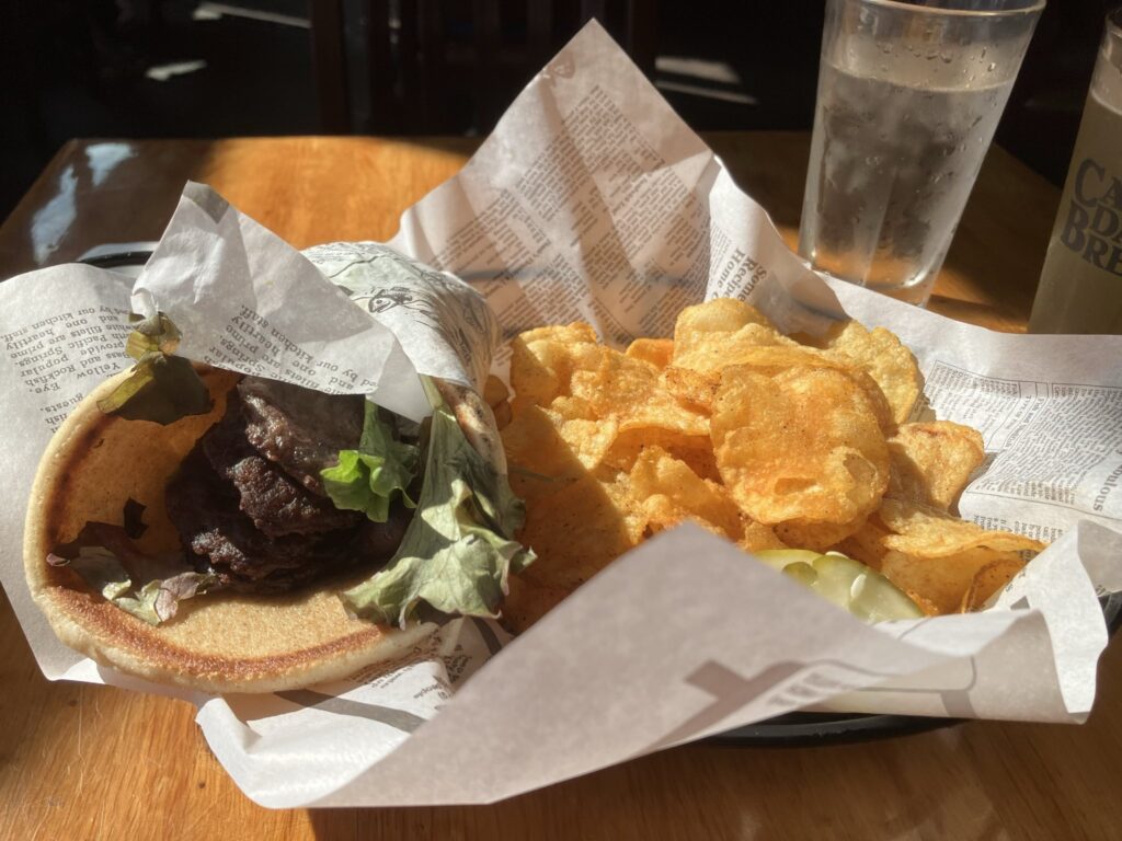
After about an hour, I stopped in to the Gunflint Saloon in Grand Marais, Minnesota to have some lunch and give my butt a break. I had a great meal and a local sour beer before it was time to resume my journey toward Duluth, Minnesota.
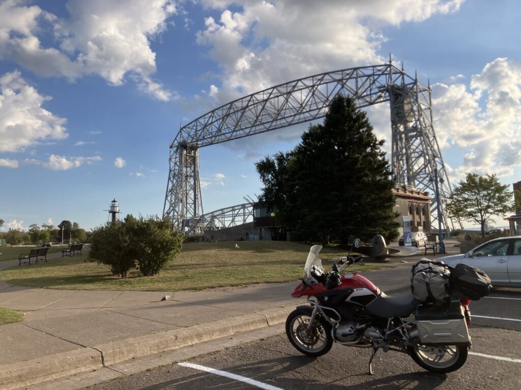
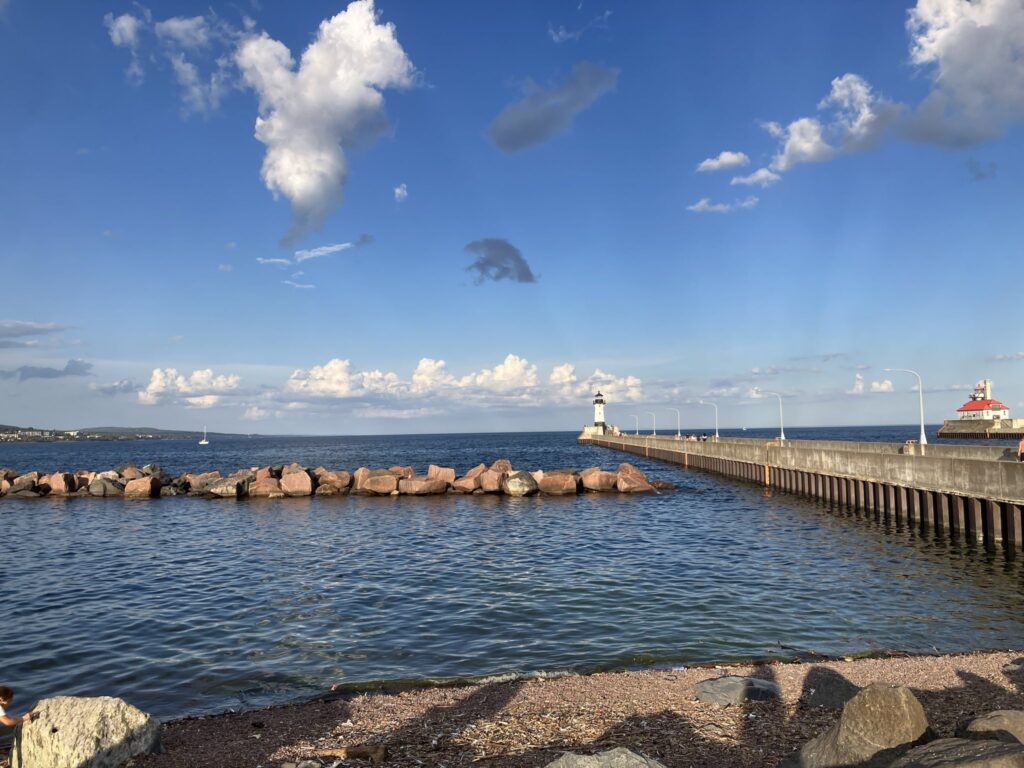
The lake views continued and eventually the far shore of the lake came into view way off in the distance. It had been nearly two full days of traveling to get around that lake without having seen the other side. It closed in as I continued on my way toward Duluth. With the weather being way nicer than our visit to Duluth on the way eastbound, I decided to stop back in at the famous Duluth Aerial Lift Bridge to snap some photos of it and the canal entry lighthouses.
I gave Marv Bohn a call to let him know I was about two hours out, and with the time reading about 6:00pm, I should be there not long after dark. It was about 30 minutes of riding in the darkness of night after twilight, but I made it to his place in Brainerd, Minnesota around 8:30pm. Today had been a long one, with 500 miles on my trip computer.
Marv and I enjoyed some cocktails and stories, as well as trying to figure out what the rest of my trip would look like. I have 6 days left to make it back to the Bay Area. I think tomorrow I’m going to try to make it to within striking distance of the Black Hills of western South Dakota. Should be a good one!
Welcome back to the States you Canadian Yank (ha ha).
Enjoying your road reports, and especially the photos. Very nice.
WWWobble
Marv would’ve liked it if you lingered a day’er two with him